Navigation and byelaws
Please note that the Port area is subject to a maximum speed limit of 10 knots in the estuary and 5 knots within the canal.
Sailing approaches
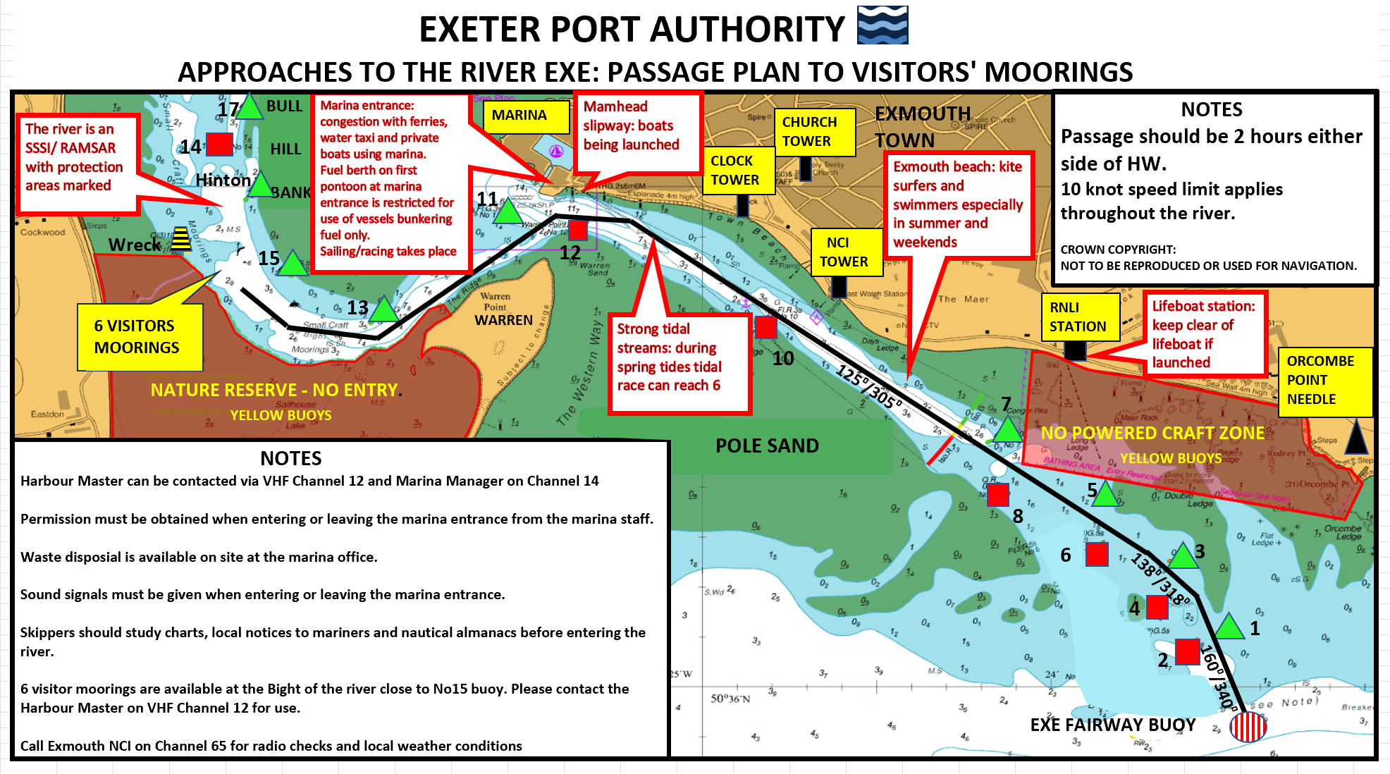
Once inside, the Estuary offers good shelter. The entrance to the Estuary is via buoyed channels through a shifting sand bank, but should be avoided in onshore winds and swell or moderate weather from the East right round to the South West. In settled conditions the best time to approach is 2 or 3 hours before high water. If unfamiliar with the approach this is best completed in daylight hours. Reference should be made to Admiralty Chart No 2290, nautical almanacs or a suitably detailed and up to date equivalent before entering the harbour.
For those in suitable craft, visitor moorings can be found a mile from the harbour entrance in The Bight. Longer term berths and storage are available within the Exeter Canal and more lively Exeter Quay. Reaching Exeter involves arranging a passage through the canal.
Exeter canal
The canal basin and quay are an historic gateway to the city and provides ample parking with easy access to sports, recreation and shops.
This area is a mix of old and new building and provides moorings for a wide range of vessels.
A walk or cycle along the tow path brings you to the Double Locks pub, or the Turf Hotel at the furthest reach of the canal.
If you are interested in mooring a craft on the canal or visiting the canal by boat, please contact the canal office (contact details below).
Please note: it is possible to leave a vessel on a deep-water berth on the canal throughout the year. Vessels can also be lifted and stored on the hard during the winter months.
Slip ways
There are a number of slipways offering access to the Exe Estuary. Further advice can be found on the Exe Estuary Partnership web site.
Summary of Exe Estuary Navigation Byelaws
Check for further information at access points and adhere to the Navigation Byelaws. Breaching any of the byelaws could result in a fine.
- Byelaw 4: Do not exceed speed limit as defined by charts and buoyage: 10 Knots Max.
- Byelaw 4a: Power boat area: powerboating allowed in marked area when predicted tidal height is 3.8m or more.
- Byelaw 5: Skiing only allowed in ski area marked by yellow buoys.
- Byelaw 6: Navigate with due care and attention and with reasonable care for others.
Vessels must also abide by the International Rules for the Prevention of Collision at Sea at all times.
Our policy is to deal with offenders through awareness and education when appropriate, but formal prosecutions will take place when necessary.
Pilotage
Vessels over 20 metres or 2.5 metre draft transiting through the port require pilotage or a pilotage exemption certificate
Please contact the Harbourmaster’s office for further details or booking.
Contacting Us
Exeter Port Authority staff can be contacted by:
- VHF radio on Channel 12 using call sign "Exeter Port Authority" during working hours
- Our office number is 01395 223 265
- There is a telephone number for urgent issues outside working hours and this is provided on the office answer machine.
2026 River Exe and Approaches Survey
J2700 - 6 and 7 May 2006: Survey Assessment
J2700 survey was conducted of the channel approaches on 6 and 7 May 2026. The survey used multibeam echo sounder (MBES) equipment to map depths between the Safe Water Buoy (SWB) and Buoy 12. Depths are shown relative to mean low water springs (MLWS).
The UK Hydrographic Office has not yet verified this data. Conditions in this area can also change frequently, so the information may not reflect current depths.
The images show depths in the following areas:
Marina to Tower
Sideshore to No 3 Buoy
Safe Water Buoy (SWB) to No 3 Buoy
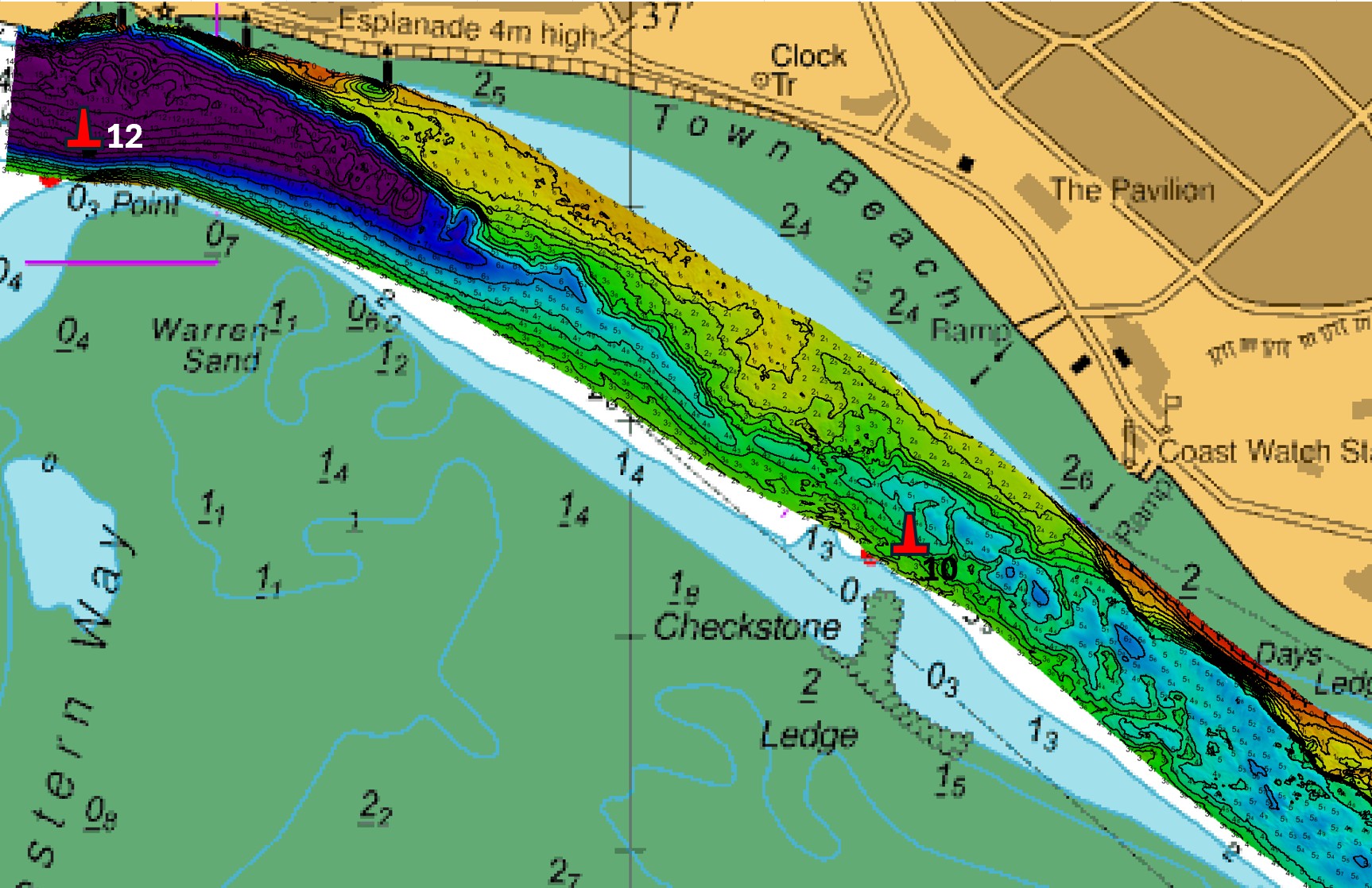
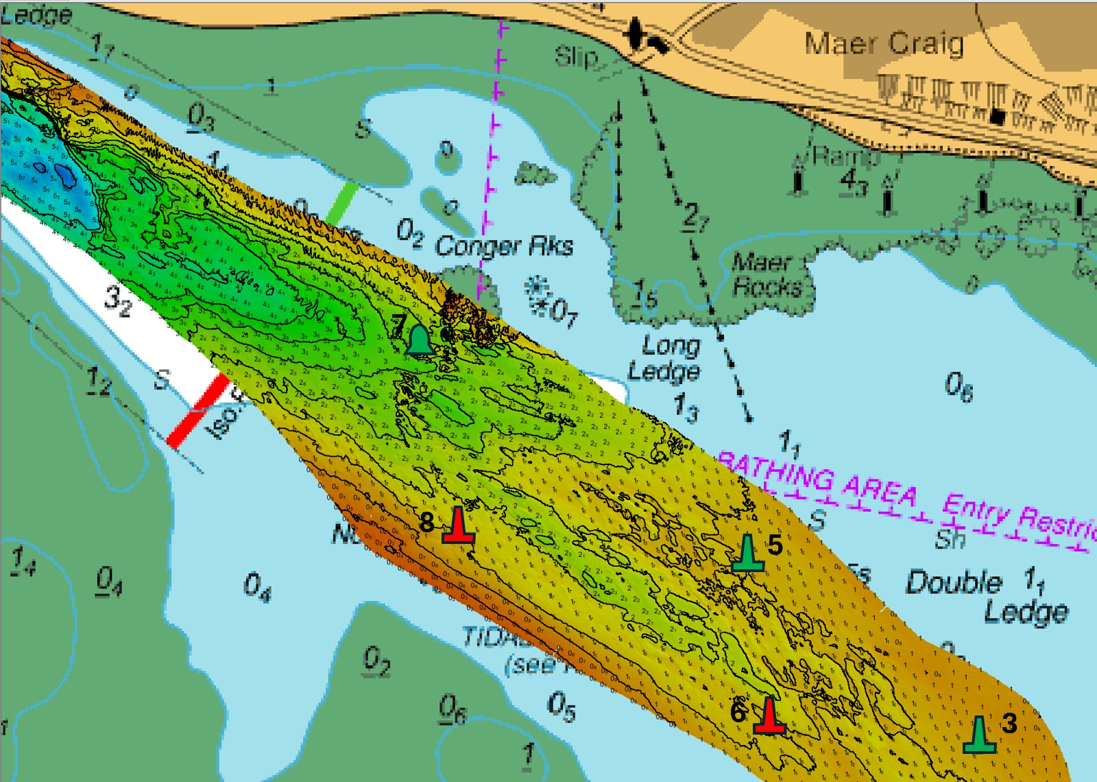
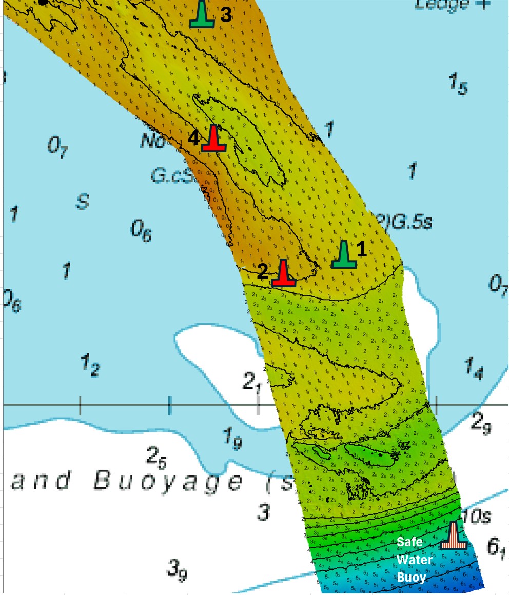
Please note: These images are for information only and must not be used for navigation. The diagrams contain Crown Copyright information and are the property of Exeter Port Authority. They must not be copied or reproduced in any form.
Changes to the west of Bull Hill Bank
Bull Bank Hill is located between Dawlish Warren spit and Cockwood Harbour, inside the Exe Estuary. The bank is close to the existing navigation channel, laying west of the navigation channel.
See an overview of the movement of the bank over the previous few years.
Port Passage Plan
Please see our Approaches to the river Exe: Passage plan to visitors' moorings.